|
|
Post by missouriboy on Dec 10, 2021 0:35:15 GMT
Houston will be close to record warmth the next several days continuing our warmer than average fall. But that could change and probably will over the coming months. spacecityweather.com/ Lol. I was just taking a sip out of my Space City Weather vacuum flask I recieved last year for donating when I saw your post. Great site. If you Texicans want some cold weather, all you have to do is pay me to drive down. Works every time.  |
|
|
|
Post by glennkoks on Dec 10, 2021 1:54:02 GMT
Lol. I was just taking a sip out of my Space City Weather vacuum flask I recieved last year for donating when I saw your post. Great site. If you Texicans want some cold weather, all you have to do is pay me to drive down. Works every time.  Did you drive down last February? |
|
|
|
Post by missouriboy on Dec 10, 2021 2:12:51 GMT
If you Texicans want some cold weather, all you have to do is pay me to drive down. Works every time.  Did you drive down last February? No. But I was seriously thinking about it. That seems to have been enough.  |
|
|
|
Post by glennkoks on Dec 10, 2021 14:50:02 GMT
NOAA's Dec outlook and 6-10 day forecast...
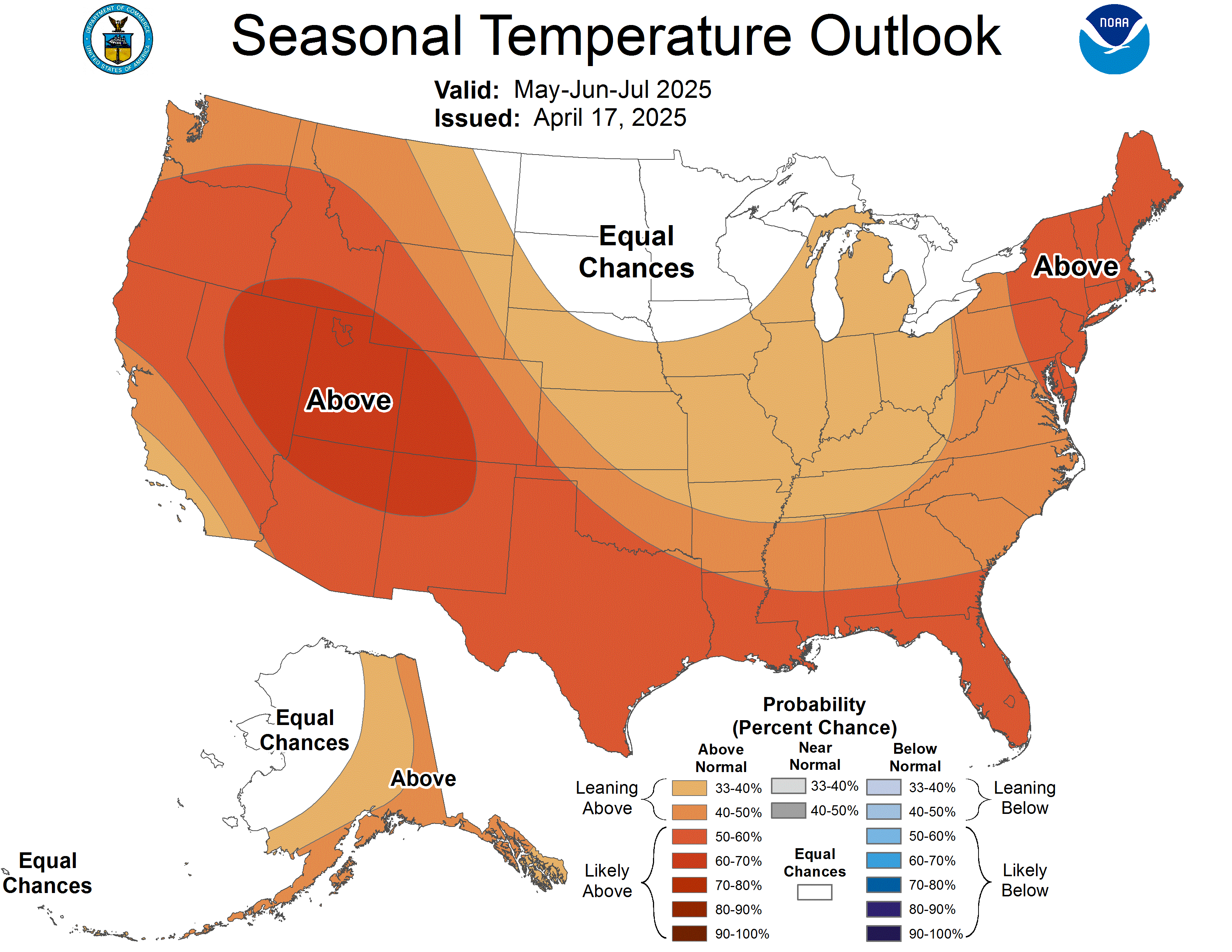
Simon, I would not put much faith at all in NOAA's seasonal forecasts. This was NOAA's seasonal forecast last year in which we experienced a record arctic outbreak that was responsible for a grid failure and 210 deaths in Texas alone.  |
|
simon
New Member

Posts: 38 
|
Post by simon on Dec 10, 2021 20:58:57 GMT
NOAA's Dec outlook and 6-10 day forecast...
Simon, I would not put much faith at all in NOAA's seasonal forecasts. This was NOAA's seasonal forecast last year in which we experienced a record arctic outbreak that was responsible for a grid failure and 210 deaths in Texas alone.  You are right but their 3-4 week outlook and monthly outlook is worth looking at...looks like some cold is finally coming our way.
|
|
Astromet
Level 3 Rank
   Meanwhile, here in the real world...
Posts: 169
|
Post by Astromet on Dec 11, 2021 14:25:34 GMT
|
|
|
|
Post by missouriboy on Dec 11, 2021 17:34:12 GMT
We were on the backside edge of that system. Some needed rain and lots of lightening. Middle Earth continues to be blessed. Prayers for the unfortunate.
|
|
|
|
Post by pbfoot on Dec 11, 2021 17:42:50 GMT
Front moved through Houston as 6am with little fanfare. No thunder or lightning that I saw. Strong north wind 20mph+. Temp was 67 at 3am. Now 60 and falling. Low 46 tonight.
|
|
Astromet
Level 3 Rank
   Meanwhile, here in the real world...
Posts: 169
|
Post by Astromet on Dec 12, 2021 2:33:18 GMT
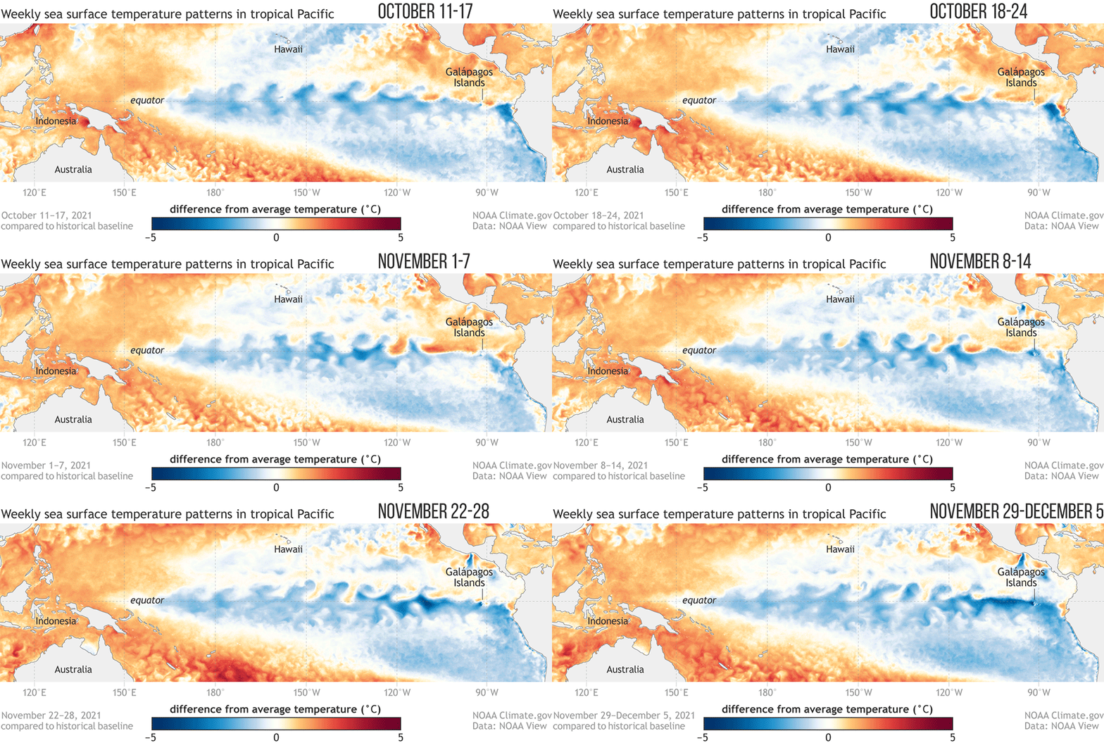
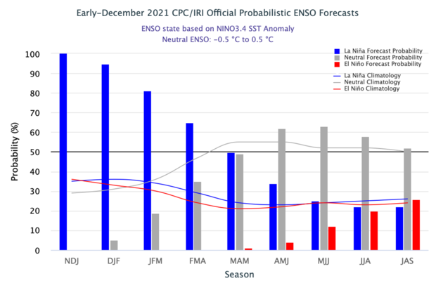
As I have long predicted since 2008 for this time in 2021, La Niña is here and this double La Nina is going to break records. Here are the sea-surface temperature difference from the long-term average from mid-October 2021 to early December 2021. The wavy features are called tropical instability waves. The equatorial eastern Pacific is usually cooler than the water just to the north and south, and cooler than the water in the far western Pacific. This region shows the the 'cold tongue' of this 2021-2022 La Niña. Now, the cooler surface along the equator is due to cold-water upwelling from the deep ocean. Any time there is a temperature difference, or gradient, between cold and warm, there is a smooth out, and tropical instability waves help mix the cooler equatorial surface with warmer off-equatorial water to the north and south.  During La Niña, the cold tongue is even colder with prominent tropical instability wave action. These waves move relatively quickly, so they usually will not show up in NOAA's monthly or seasonal sea surface temperature maps. As you can see, La Niña’s hallmark cooler-than-average ocean surface is readily apparent across much of the tropical Pacific. Over the last several weeks, cool anomalies have increased in the eastern Pacific, and in general you can see what is a well-established La Niña pattern. Also characteristic of La Niña is the warmer-than-average surface temperatures in the far western Pacific.  The sea surface temperature in the Niño-3.4 region of the tropical Pacific, which is NOAA's primary ENSO monitoring index, was about 0.9 °C cooler than the long-term (1991–2020) average. This is according to ERSSTv5, what amounts to their reliable dataset. I continue to predict that this La Niña will continue through December 2021, and into January, February, March, and start to wane by April 2022 according to my Astromet calculations. Also note how there is a large pool of cooler-than-average water under the surface - which means La Niña is not going anywhere soon. |
|
simon
New Member

Posts: 38 
|
Post by simon on Dec 17, 2021 20:52:24 GMT
The latest forecast from Dr. Judah Cohen with an excerpt below...enjoy!
"In conclusion I think we have reached a fork in the road. The first path is an overall mild winter with an ongoing T-S-T coupling that favors a positive AO, a strong stratospheric PV and relatively mild temperatures. We are currently entering a period that is an interruption to the overall mild pattern, it will likely last into the beginning of the year but much of January and February will be mild. The alternate path is that we are concluding our extensive mild period and the continuation of the mild period is being discontinued or disrupted by favorable placement of ridge/high pressure centers that in the short term is allowing the NH landmasses to cool significantly. But I do think for the relatively cold pattern to have longevity, it needs to involve the stratospheric PV either through a classical SSW or alternatively a stretched PV but in the former disruption, it would likely need to occur multiple times to have a discernable impact on the seasonal means. Again, I do think that the best plot to determine which path we are on the PCH and WAFz plots are critical."
|
|
simon
New Member

Posts: 38 
|
Post by simon on Dec 17, 2021 20:55:08 GMT
NOAA's latest 6-10 and 8-14 day forecast along with their 3-4 week outlook.
|
|
|
|
Post by missouriboy on Dec 17, 2021 23:45:13 GMT
The latest forecast from Dr. Judah Cohen with an excerpt below...enjoy!
"In conclusion I think we have reached a fork in the road. The first path is an overall mild winter with an ongoing T-S-T coupling that favors a positive AO, a strong stratospheric PV and relatively mild temperatures. We are currently entering a period that is an interruption to the overall mild pattern, it will likely last into the beginning of the year but much of January and February will be mild. The alternate path is that we are concluding our extensive mild period and the continuation of the mild period is being discontinued or disrupted by favorable placement of ridge/high pressure centers that in the short term is allowing the NH landmasses to cool significantly. But I do think for the relatively cold pattern to have longevity, it needs to involve the stratospheric PV either through a classical SSW or alternatively a stretched PV but in the former disruption, it would likely need to occur multiple times to have a discernable impact on the seasonal means. Again, I do think that the best plot to determine which path we are on the PCH and WAFz plots are critical."
Whatever it is ... she's a-comin. |
|
|
|
Post by Weathergeek on Dec 18, 2021 3:26:55 GMT
So far it has been a very warm start to the winter in aggregate and has not started early. It does not appear this forecast will be correct for a long cold snowy winter unless the weather changes in a hurry.
|
|
|
|
Post by missouriboy on Dec 18, 2021 7:07:25 GMT
So far it has been a very warm start to the winter in aggregate and has not started early. It does not appear this forecast will be correct for a long cold snowy winter unless the weather changes in a hurry. A time period with many extremes often does more damage (like Texas last February) than flash-freezing us till spring. North America is just one part. From reports, it was not a warm start in parts of Asia and Europe. We will see where and when (or if) the properly located "bumps" in the vortex direct the jet stream our way and for how long. The last one didn't propagate as far south as the models wanted to take it. I just want "enough" cold to kill a bunch of ticks AND climate modelers.  It would be nice if it was a "definitive" leveler. But I can't expect anybody to successfully call the magnitude and timing of every bump(s) - block(s) in the pressure system. If it doesn't show up, it won't break my heart. But don't warm up to the point that my apples and peaches start budding and then get zapped ... like they did last spring. |
|
simon
New Member

Posts: 38 
|
Post by simon on Dec 18, 2021 15:33:10 GMT
NOAA's January Outlook...We'll see how this one pans out.
|
|